


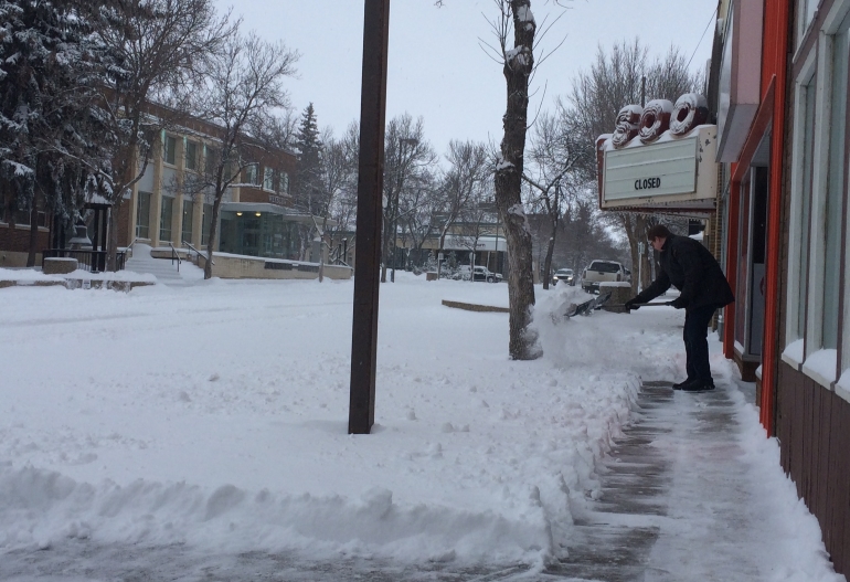
Weyburn, along with a good portion of the province, is cleaning up after a snowstorm battered Saskatchewan starting Sunday afternoon and continuing into Monday morning. Upwards of 20 centimetres, or eight inches, fell on Weyburn. The result is city streets packed with snow, making driving difficult.
The snow also causing problems on highways in the region. Travel was not recommended on many of the highways in the area due to blowing, drifting snow, along with reduced visibility and icy and slippery sections. As of now, though, the only advisory still in place where travel was not recommended is for Highway 13 east of Weyburn to Stoughton.
The weather has prompted the cancellation of a number of buses Monday for schools in the South East Cornerstone Public School Division. All buses for Ogema, Pangman, Midale, and Yellow Grass have been cancelled. All rural buses for Weyburn schools have been cancelled as well. In Weyburn itself, Charmaine Verbeurgt's bus, route 82-201, which serves Weyburn Comprehensive School, has been cancelled.
Additionally, all of the rural buses serving St. Michael's School in Weyburn have been cancelled for the day. All buses for St. Michael's serving city routes will run as normal.
The Weyburn Police Service is still advising those who do not have to travel or drive in the city to not venture out. If it is necessary to travel, they are reminding motorists to drive for the conditions and to clear vehicles of any snow before departing.

Here in Weyburn, City crews will be focusing on primary and secondary routes and troubles spots as they pop up. Sanders will be out to help with intersections as well. A full city-wide snow clearing plan will be put together once the snowfall stops.
The heavy snowfall has also prompted the closure of the Weyburn airport. It will remain closed until the snow is able to be removed from the area.
As for downtown Weyburn, the overnight snow removal will likely happen Tuesday or Wednesday night.
Environment Canada is calling for more snow to fall throughout the day Monday. Another 10 to 15 centimetres could fall by Tuesday morning, as the last part of the Colorado Low responsible for the weather makes its way north of the border.
The storms being experienced by the region are causing some unusual weather patterns as well. The energy contained in the storms on Sunday south of the border triggered a rare phenomenon known as thundersnow, which is a thunderstorm with snowfall instead of rainfall. Lightning was detected in a number of areas around southeast Saskatchewan, and southwest Manitoba Sunday. It isn’t expected to happen again on Monday, however, as the air has cooled significantly.
You can find out the latest highway conditions on our Road Report page, and see what the latest weather forecast is with our Five Day Forecast.


 Tue, Apr 30, 12:00 PM
 Full-time, Agriculture, Skilled Trades
 Featured


